Bandung City
Bandung is the capital of West Java province in Indonesia. According to the 2015 census, it is Indonesia's fourth most populous city after Jakarta, Surabaya, and Bekasi with over 2.5 million inhabitants. At the meantime, Greater Bandung is the country's third largest metropolitan area with over 8 million inhabitants. Located 768 metres (2,520 feet) above sea level, approximately 140 kilometres (87 miles) southeast of Jakarta, Bandung has cooler year-round temperatures than most other Indonesian cities. The city lies on a river basin surrounded by volcanic mountains. This topography provides a natural defense system, which was the primary reason for the Dutch East Indies government's plan to move the colony capital from Batavia (modern-day Jakarta) to Bandung.

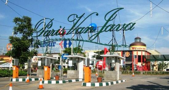
The Dutch colonials first established tea plantations around the mountains in the eighteenth century, and a road was constructed to connect the plantation area to the colonial capital Batavia (180 kilometres (112 miles) to the northwest). The Dutch inhabitants of Bandung demanded the establishment of a municipality (gemeente), which was granted in 1906, and Bandung gradually developed into a resort city for plantation owners. Luxurious hotels, restaurants, cafés, and European boutiques were opened, hence the city was nicknamed Parijs van Java (Dutch: "The Paris of Java").
After Indonesia declared independence in 1945, the city experienced rapid development and urbanization, transforming Bandung from an idyllic town into a dense 16,500 people/km2 (per square kilometer) metropolitan area, a living space for over 8.5 million people. New skyscrapers, high-rise buildings, bridges, and gardens have been constructed. Natural resources have been heavily exploited, particularly by conversion of protected upland area into highland villas and real estate. Also, although the city has encountered many problems (ranging from waste disposal and floods to a complicated traffic system resulting from a lack of road infrastructure), Bandung still attracts large numbers of tourists, weekend sightseers, and migrants from other parts of Indonesia. The city has won a regional environmental sustainability award for having the cleanest air among other major cities in ASEAN countries in 2017. The city has also become known as a Smart City, leveraging technology to improve government services, including social media, that alert the authorities to issues such as floods or traffic jams.

The first Asian-African Conference, also known as the Bandung Conference was hosted in Bandung by President Sukarno in 1955. Redevelopment of the international airport was completed in 2016. To improve infrastructure, the construction of a Jakarta-Bandung High Speed Rail and Bandung Metro Kapsul, a type of indigenous Automated People Mover (APM) will begin in 2018. The new Bandung Kertajati International Airport opened in June 2018 with a 2,500 meter long runway and only one flight per day to Surabaya.
Geography
Bandung, the capital of West Java province, located about 180 kilometres (110 mi) southeast of Jakarta, is the third largest city in Indonesia. Its elevation is 768 metres (2,520 ft) above sea level and is surrounded by up to 2,400 metres (7,900 feet) high Late Tertiary and Quaternary volcanic terrain. The 400 km2 flat of central Bandung plain is situated in the middle of 2,340.88 square kilometres (903.82 sq mi) wide of the Bandung Basin; the basin comprises Bandung, the Cimahi city, part of Bandung Regency, part of West Bandung Regency, and part of Sumedang Regency. The basin's main river is the Citarum; one of its branches, the Cikapundung, divides Bandung from north to south before it merges with Citarum again in Dayeuhkolot. The Bandung Basin is an important source of water for potable water, irrigation, and fisheries, with its 6,147 million m3 (217.1 billion cu ft) of groundwater being a major reservoir for the city. The northern section of Bandung is hillier than other parts of the city, and the distinguished truncated flat-peak shape of the Tangkuban Perahu volcano (Tangkuban Perahu literally means 'upside-down boat') can be seen from the city to the north. Long-term volcanic activity has created fertile andisol soil in the north, suitable for intensive rice, fruit, tea, tobacco, and coffee plantations. In the south and east, alluvial soils deposited by the Cikapundung river predominate.
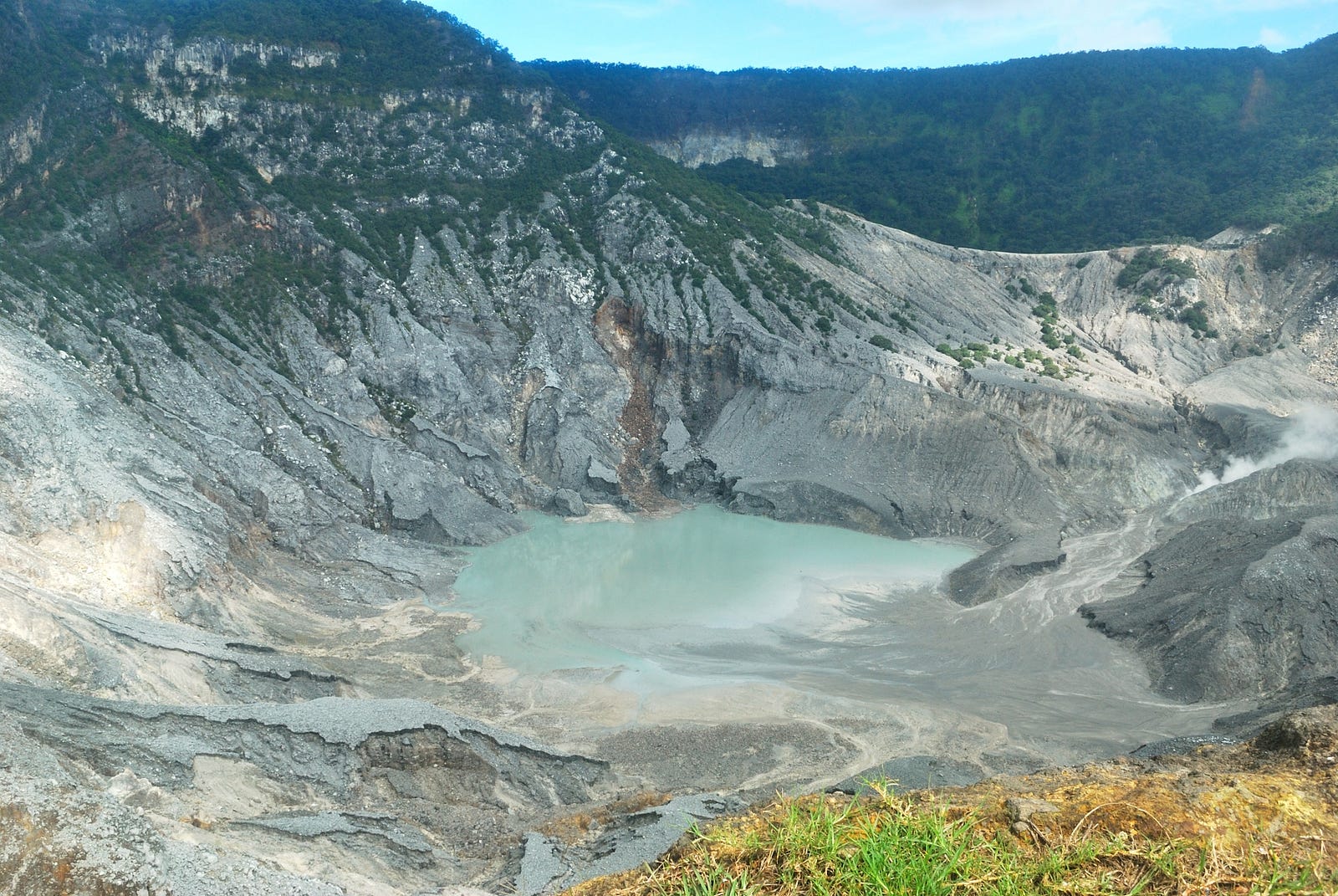
Geological data shows that the Bandung Basin is located on an ancient volcano, known as Mount Sunda, erected up to 3,000–4,000 metres (9,800–13,100 feet) during the Pleistocene age.[9] Two large-scale eruptions took place; the first formed the basin and the second (est. 55,000 Before Present) blocked the Citarum river, turning the basin into a lake known as "the Great Prehistoric Lake of Bandung". The lake drained away; for reasons which are the subject of ongoing debate among geologists.
Climate
Bandung experiences tropical monsoon climate (Am) according to Köppen climate classification as the driest month precipitation total is below 60 millimetres (2.4 in), bordering with subtropical highland climate (Cfb). The wettest month is February with precipitation total 255.0 millimetres (10.04 in), while the driest month is September with precipitation total 50.0 millimetres (1.97 in). The average temperature throughout the year tends to be cooler than most cities in Indonesia due to the altitude influence. The average temperature throughout the year only has little variation due to its location near the equator.

Tidak ada komentar:
Posting Komentar